Exhibition 6 of 8
Gaza, by Name
The district before the Strip
Before Gaza was a strip it was a district: grain villages, a weaving town, orchards along the coast road. This walk names the places that were emptied into it, and the camps their people built on top of themselves.
14 stops · walked in order
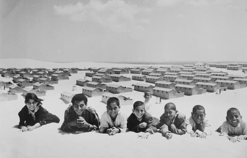
Cover image: Khan Younis refugee camp, 1955. UNRWA photo (public domain), via Wikimedia Commons
Gaza is normally introduced as a number: square kilometres, population density, casualties. This exhibition introduces it as a list of names. The Gaza district of Mandate Palestine ran up the coast well past the present fence — grain villages inland, orchards and dunes along the shore, market towns on the highway to Jaffa — and in 1948 it was cleared into the narrow rectangle that survived. Most of Gaza’s population is not from Gaza. It is from the places in the first half of this walk, which are between fifteen and forty kilometres away.
The clearing was quick and it was mostly done by one formation. The Palmach’s Negev Brigade took Burayr and Simsim in mid-May 1948, expelled Najd on the 13th — two days before the Mandate legally ended — and drove out Kaufakha and al-Muharraqa at the end of the month. Isdud, ancient Ashdod, held as the Egyptian army’s northernmost position until Operation Yoav in late October. Al-Majdal, a town of some ten thousand known for its weaving, fell in November 1948 and was not emptied then: its remaining residents were held under military government and expelled into Gaza in 1950, two years after the war, in an operation that has no plausible battlefield explanation.
The second half of the walk is what those people built. Jabaliya, Khan Younis and Deir al-Balah were already places — a market town, a Mamluk caravanserai from 1387, a monastery from the fourth century — and each acquired a camp that grew larger than the town it was attached to. The camps were laid out by origin, so that a Jaffa neighbourhood exists inside Jabaliya and a family from Jusayr or Julis can still tell you which alley belongs to which village. This is why the naming matters: the geography of the destroyed district was rebuilt, at one-tenth scale, inside the Strip.
The bookkeeping came afterwards and has been fought over ever since. UNRWA’s working definition of a Palestine refugee covers a person whose normal residence was Palestine between 1 June 1946 and 15 May 1948 and who lost both home and livelihood in the 1948 war, with descendants eligible for registration. As of early 2024, by Al Jazeera’s account of the agency’s figures, 1,476,706 Palestinians in Gaza were registered as refugees across eight camps. Every one of those registrations points back to a specific village, and most of those villages are in the first half of this exhibition.
Walk it in order, and the shape of the thing becomes hard to mistake. The people of the Gaza district were not scattered across the world; they were concentrated, deliberately, into the smallest part of their own district, and then registered, enclosed, and counted. The names in this walk are the answer to the question of who they were before that happened.
Sources
Drawn from 6 villages · 3 testimonies · 3 places · 1 glossary term · 1 research entry.
- 01
BurayrVillage
Gaza
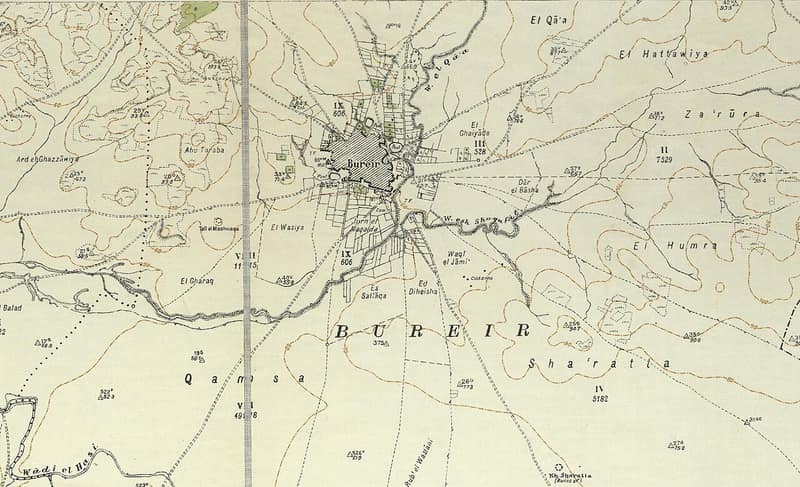
One of the largest grain-growing villages of the Gaza coast. It twice drove off attackers before the Palmach's Negev Brigade took it in a single night in May 1948.
Burayr, one of the largest grain-growing villages of the Gaza coast, twice drove off attackers in early 1948 before the Palmach's Negev Brigade seized it in a single night in May, days before the Mandate ended. Five Israeli settlements were planted on its lands; scattered cactuses and the trace of its streets mark the site.
Open this record↑ StartStop 2 ↓ - 02
SimsimVillage
Gaza
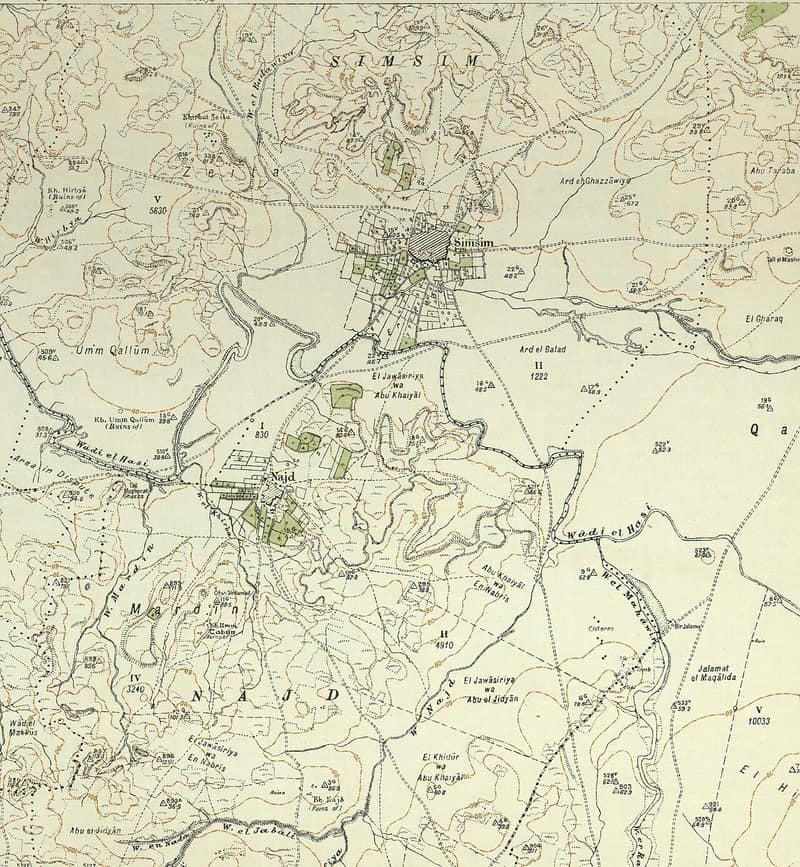
A circular village of gardens and deep wells, emptied a day after Burayr. The site was obliterated; the cypress and sycamore stayed.
Simsim, a circular village of gardens and deep wells northeast of Gaza and the hometown of a leader of the 1936 revolt, was captured and emptied by the Palmach's Negev Brigade in mid-May 1948, a day after neighboring Burayr fell. The site was obliterated; only cypress and sycamore trees mark it.
- 03
NajdVillage
Gaza
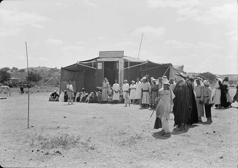
Its children walked to school in Simsim. Its people were expelled on 13 May 1948, two days before the Mandate ended; Sderot was founded on its land.
Najd — its name means 'elevated ground' — was a small farming village northeast of Gaza whose children walked to school in Simsim. Its people were expelled by the Palmach's Negev Brigade on 13 May 1948, two days before the Mandate ended; Sderot was founded on its lands in 1951.
- 04
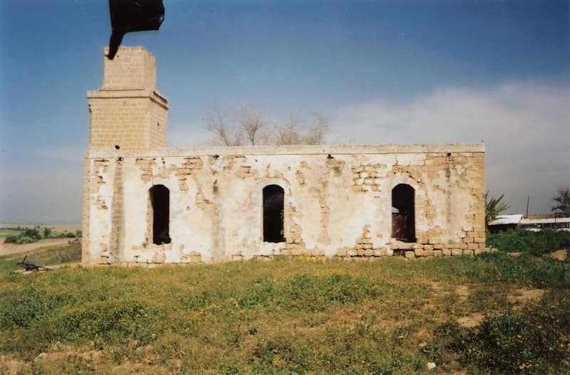
KaufakhaVillage
Gaza
Its people asked repeatedly to surrender and stay. They were expelled in late May 1948 regardless. Only the mosque remains.
Kaufakha was a farming village east of Gaza, founded by Gaza city families in the late nineteenth century around a well-known mosque. Its people repeatedly asked to surrender and stay, to no avail: the Palmach's Negev Brigade expelled them in late May 1948. Only the mosque remains, used as a stable and fodder store.
- 05
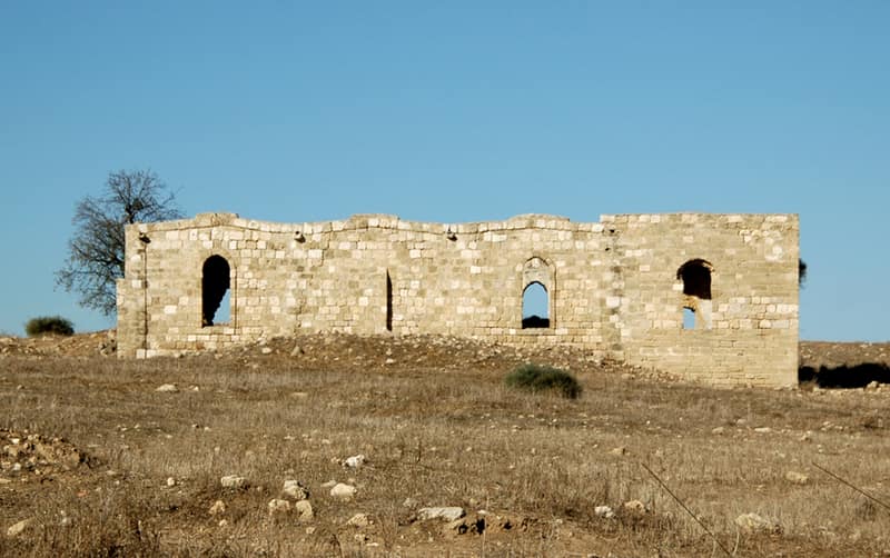
IsdudVillage
Gaza
Ancient Ashdod: a market town of nearly five thousand on the coastal highway, with a Wednesday market and a railway station. The Egyptian army's northernmost stand.
Isdud — ancient Ashdod — was a market town of nearly five thousand on the coastal highway north of Gaza, with two mosques, three shrines, schools, a train station, and a Wednesday market. It was the Egyptian army's northernmost stand of 1948, falling in late October during Operation Yoav; modern Ashdod rose on its lands.
- 06
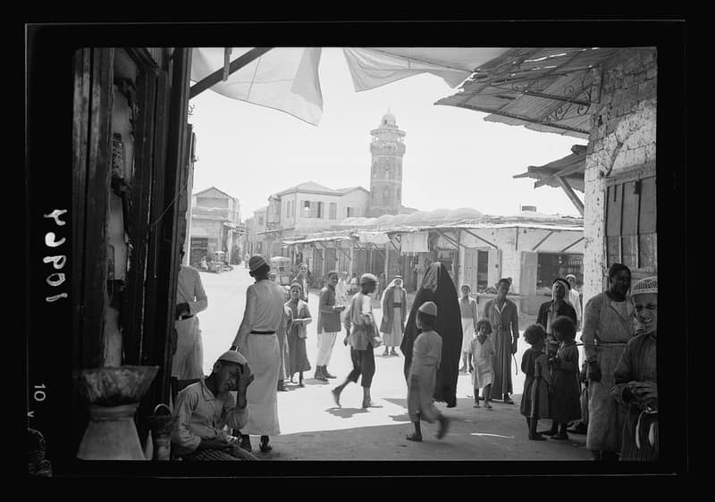
Al-MajdalVillage
Gaza
The weaving town of ten thousand that was captured in November 1948, held under military rule for two years, and then expelled — in 1950 — into Gaza.
Al-Majdal (Majdal Asqalan) was a market town of some ten thousand people, famed for its weaving, on the coastal plain north of Gaza. Captured in November 1948, its remaining residents were held under military rule and finally expelled to Gaza in 1950; the town became the Israeli city of Ashkelon's Migdal quarter.
- 07
Umm OmarTestimony
Eight years old at the expulsion from Jusayr, and in Jabaliya camp ever since. She itemises what the family had, and then what followed.
Eight years old when her family was expelled from Jusayr in 1948; she has lived in Jabaliya refugee camp ever since.
- 08
Dalal NassarTestimony
She walked to Gaza as a girl in 1948 and spent the first years in tents at Deir al-Balah. The camps in this walk begin in accounts like hers.
An 84-year-old refugee from Julis recalls walking to Gaza as a girl during the 1948 exodus and the humiliation of the first years in tents at Deir al-Balah.
- 09
Wajiha al-HarshTestimony
She fled Jaffa in May 1948 and has spent seventy years in the Jaffa neighbourhood of Jabaliya camp — the destroyed map, rebuilt at one-tenth scale.
An 80-year-old refugee from Jaffa, living in the Jabaliya camp's 'Jaffa neighborhood' in Gaza, recalls the panic of the May 1948 flight from her city.
- 10
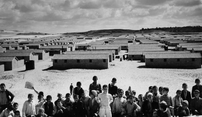
JabaliaPlace
Gaza Strip
The market town on the rise northeast of Gaza City, and after 1948 the largest refugee camp in the Strip. The first intifada began in its alleys in December 1987.
Jabalia, the market town on the rise northeast of Gaza City, became after 1948 the site of the largest refugee camp in the Strip; the first intifada began in its alleys in December 1987, and the war since 2023 has returned to it again and again.
- 11
Khan YounisPlace
Gaza Strip
A Mamluk caravanserai of 1387 that became the district's second town, and then one of the Strip's largest camps.
Khan Younis began in 1387 as a Mamluk caravanserai on the Egypt road and grew into the Gaza district's second town; 1948 made its refugee camp one of the Strip's largest, November 1956 left it a massacre to mourn, and the war since 2023 has left much of the city in ruins.
- 12
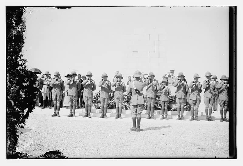
Deir al-BalahPlace
Gaza Strip
The Monastery of Dates: a fourth-century monastery, a Bronze Age cemetery under the soil, and after 1948 a town and a camp occupying the same ground.
Deir al-Balah — the 'Monastery of Dates' — grew around a fourth-century monastery on the ancient coast road, hid a Bronze Age cemetery beneath its soil, and after 1948 became town and refugee camp together in the narrow heart of the Gaza Strip.
- 13
Palestine RefugeeGlossary
society
The working definition, stated exactly — because almost every argument about Gaza's population is in fact an argument about this paragraph.
A Palestine refugee, in UNRWA's working definition, is a person whose normal place of residence was Palestine between 1 June 1946 and 15 May 1948 and who lost both home and means of livelihood as a result of the 1948 war. Descendants are also eligible for registration; today some 5.9 million Palestine refugees are registered with the agency.
- 14
UNRWA — UN Relief and Works Agency for Palestine RefugeesResearch
UNRWA
The agency that registers them, and the reason the register exists at all.
Established by UN General Assembly Resolution 302 (IV) in December 1949, UNRWA provides education, health care, and relief to millions of registered Palestine refugees in Jordan, Lebanon, Syria, the West Bank, and Gaza.
Open this record↑ Stop 13End of the walk
End of the walk
You have passed 14 stops across 5 rooms of the archive. Every one of them is a full record with its own sources — the exhibition supplied only the order.
Exit through the archive
Cite this page
Every claim above carries its sources — citation is the point.
- Chicago
“Gaza, by Name.” Exhibitions, FALASTEEN.AI. Accessed 22 August 2026. https://falasteen.ai/exhibitions/gaza-by-name.- MLA
“Gaza, by Name.” Exhibitions, FALASTEEN.AI, 2026, https://falasteen.ai/exhibitions/gaza-by-name. Accessed 22 August 2026.- BibTeX
@misc{falasteen-gaza-by-name,
  title        = {Gaza, by Name},
  howpublished = {\url{https://falasteen.ai/exhibitions/gaza-by-name}},
  organization = {FALASTEEN.AI — A Living Archive for Palestine},
  year         = {2026},
  note         = {Accessed 2026-08-22}
}