Tiberias district · depopulated 1948 · 3 min read
Hittin
حطّين
Hittin stood below the Horns of Hattin, where Salah al-Din defeated the Crusader armies in 1187, eight kilometres from Tiberias. Its 1,190 Muslim inhabitants held 22,764 dunums in 1944/45. The Seventh Brigade took the village on 17 July 1948 during Operation Dekel; those who tried to return were fired on, and most ended in Lebanon. The mosque and the shrine of al-Nabi Shu'ayb still stand.
See Hittin on the Atlas32.8076°N · 35.4538°E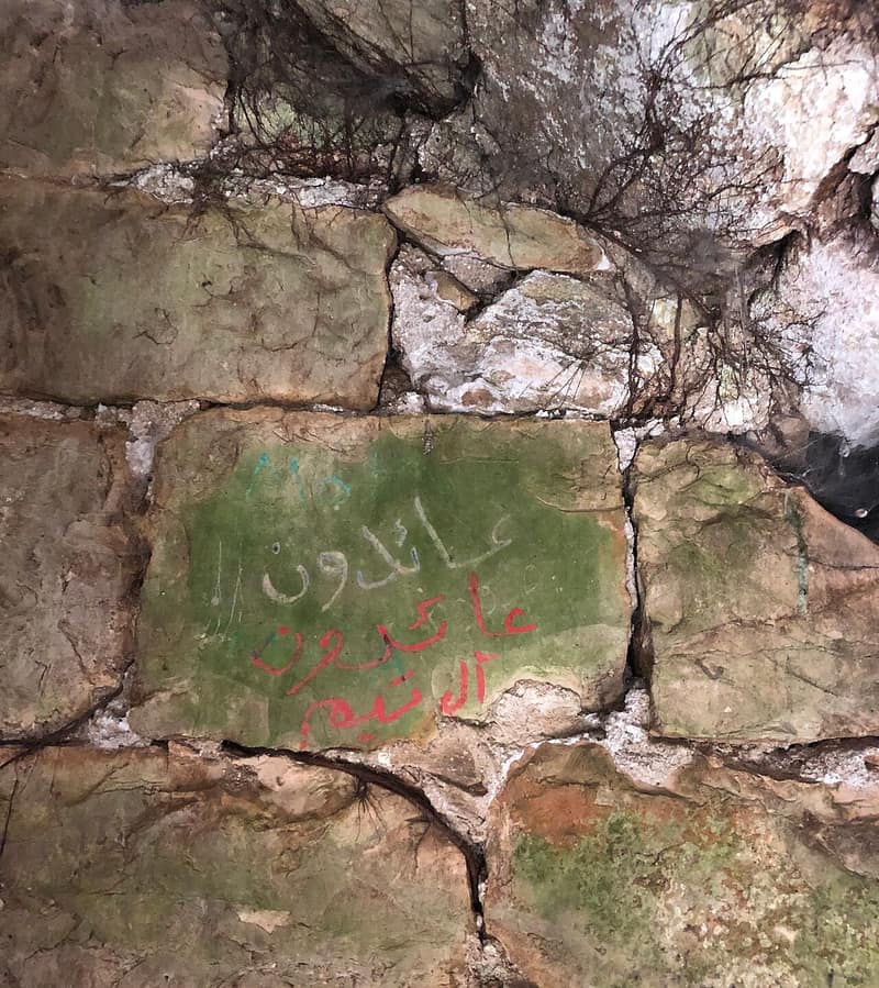
Hittin lay on the banks of a small wadi at the northern foot of Mount Hittin, commanding the plain that opens east to the lowlands of Lake Tiberias and west, through mountain passes, to the plains of the lower Galilee — a corridor used by caravans and armies for as long as there are records of either. The village may stand over the Canaanite Ziddim; it was Kfar Hittaya in the Roman period and a rabbinical seat in the fourth century. On the plain below, in 1187, Salah al-Din destroyed the Crusader armies and secured the whole Galilee. Muslim geographers and chroniclers, among them Yaqut al-Hamawi and al-Ansari al-Dimashqi, who was himself called the Shaykh of Hittin, linked a series of early Islamic figures to the village. In 1596 it had 605 inhabitants paying tax on wheat, barley and olives.
The modern village was triangular and level-streeted, with a small market, an elementary school founded around 1897 under Ottoman rule, and a mosque for its entirely Muslim population. On the southwestern outskirts stood the shrine of the prophet Shu’ayb, especially sacred to the Druze, who made pilgrimage there each April; the shrine had a prayer hall believed to hold the tomb and footprint of the prophet, guest rooms, and a spring beside it. Good soil, rain and groundwater made for a strong agricultural economy: of 22,764 dunums, 10,253 were sown in cereals in 1944 and 1,936 irrigated or planted in orchards. The 1944/45 population was 1,190, all Muslims.
The war reached Hittin on 9 June 1948, when an Israeli attack on neighbouring Lubya was repulsed just before the first truce; villagers interviewed by the historian Nafez Nazzal described firing on the retreating armour from positions above the Nazareth–Tiberias road, then holding the Horns of Hittin for four hours against an armoured and infantry advance until it withdrew. The next attack came from the Seventh Brigade after the truce ended, during Operation Dekel. When Nazareth fell on 16 July the twenty-five to thirty Arab Liberation Army soldiers stationed at Hittin began to withdraw, and most villagers left on the night of 16–17 July for Salama, between Dayr Hanna and al-Mughar. The village was occupied on 17 July. Five men who went back to assess the chances of retaking it were fired on; one man managed to return and bring out his parents. The villagers waited on the outskirts for a month for a chance to go home before heading for Lebanon.
Israel established Arbel north of the site in 1949 and Kefar Zetim to the northeast a year later, both on village land. The site is overgrown with grass and scattered with heaps of stone; mulberry, fig and eucalyptus grow among them and water plants in the shallow streams. The mosque is deserted, its minaret intact and its arches crumbling. The shrine of al-Nabi Shu’ayb still stands on the hillside and remains a place of Druze pilgrimage; the Druze community was granted custodianship of the shrine and a hundred surrounding dunums in the 1950s, and the annual pilgrimage was recognised by Israel as a religious holiday in 1954. Proposals that internally displaced Palestinians be allowed to resettle the village were rejected on security grounds.
Sources
Cited works
3- palquest.org — hittin(opens in a new tab)https://www.palquest.org/en/place/17000/hittin
- zochrot.org — en(opens in a new tab)https://www.zochrot.org/villages/village_details/49170/en
- en.wikipedia.org — Hittin(opens in a new tab)https://en.wikipedia.org/wiki/Hittin
Connected in the archive
8 connected records8 records elsewhere in the archive are linked to this one, each by a piece of evidence you can read below.
names this place — 3 records
One record names the other. A pointer for reading, not a claim that they belong to each other.
- Ayn Hawdعين حوض
Evidence — Inferred from the text — read the evidence: Its people believed the village had been founded by Abu al-Hayja, a commander of Saladin said to have died after the battle of Hittin in 1187.
- Hiribyaهِرِبْيا
Evidence — Inferred from the text — read the evidence: In 1244 Hiribya was the site of a battle between Muslim forces and a joint force of Crusaders and Syrian Muslim recruits which historians consider second in strategic significance only to Hittin in 1187.
- Khirbat al-Wa'ra al-Sawda'خربة الوعرة السوداء
Evidence — Inferred from the text — read the evidence: A secondary road linked it to the highway that ran along the lake shore into Tiberias, and a dirt road ran southwest to Hittin; the houses were grouped in an irregular pattern around the crossing of the two.
named in this record — 1 record
One record names the other. A pointer for reading, not a claim that they belong to each other.
- Tiberiasطبريا
Evidence — Inferred from the text — read the evidence: Hittin stood below the Horns of Hattin, where Salah al-Din defeated the Crusader armies in 1187, eight kilometres from Tiberias.
in the same district — 4 records
Filed near each other — the same Mandate district, or the same uncommon subject tags.
- Ghuwayr Abu Shushaغوير أبو شوشة
Evidence — From a recorded field in this archive: Both recorded in the Tiberias district.
- Lubyaلوبيا
Evidence — From a recorded field in this archive: Both recorded in the Tiberias district.
- Nasir al-Dinناصر الدين
Evidence — From a recorded field in this archive: Both recorded in the Tiberias district.
- Samakhسمخ
Evidence — From a recorded field in this archive: Both recorded in the Tiberias district.
Cite this page
Every claim above carries its sources — citation is the point.
- Chicago
“Hittin.” Village Memory, FALASTEEN.AI. Accessed 22 August 2026. https://falasteen.ai/memory/hittin.- MLA
“Hittin.” Village Memory, FALASTEEN.AI, 2026, https://falasteen.ai/memory/hittin. Accessed 22 August 2026.- BibTeX
@misc{falasteen-hittin,
  title        = {Hittin},
  howpublished = {\url{https://falasteen.ai/memory/hittin}},
  organization = {FALASTEEN.AI — A Living Archive for Palestine},
  year         = {2026},
  note         = {Accessed 2026-08-22}
}