Hebron district · depopulated 1948 · 2 min read
Zikrin
ذكرين
Zikrin grew grain where the southern coastal plain meets the foothills of the Hebron mountains. The Giv'ati Brigade occupied it in late October 1948 during Operation Yoav; its site, known as Khirbet Dhikrin, is overgrown scrub marked by broken terraces, olive and carob trees, and the rubble of houses.
See Zikrin on the Atlas31.6634°N · 34.8606°E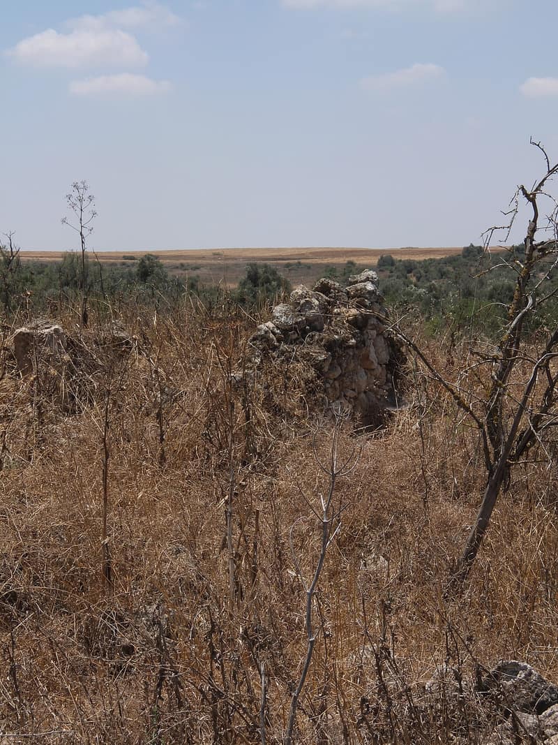
Zikrin lay twenty-seven kilometers northwest of Hebron, at the easternmost edge of the southern coastal plain, just below the western foothills of the Hebron mountains. Secondary roads tied it to Bayt Jibrin by way of Kudna, and through ‘Ajjur to the highway running northeast to the Jerusalem–Jaffa road. The site was inhabited deep into antiquity — it has been identified with the Roman-period Kefar Dikrina — and in the Ottoman register of 1596 it paid taxes on wheat, barley, sesame, fruit, and vineyards. The modern villagers, all Muslims, lived in houses of stone, mud, and wood strung along two roads, with an elementary school and a few small shops; wells in the valley to the north watered their gardens. In 1945 they numbered 960 and held more than 17,000 dunums, the great bulk of it sown with cereals.
The end came with Operation Yoav. On 22–23 October 1948 — Zochrot dates the occupation to 23 October — the Giv’ati Brigade stormed Zikrin along with a cluster of other villages in the Hebron area, in a push coordinated with the offensive against the Egyptian army further south. According to Benny Morris, most of the population of the Hebron-area villages had already fled the fighting; those who remained were expelled.
No Israeli settlement was established on Zikrin’s lands; Beit Nir, founded in 1955 on the lands of neighboring Kudna, lies about three kilometers south of the site. Today the ruin — called Khirbet Dhikrin — is thick with weeds, scrub, and wild grass, shaded by olive and carob trees. Truncated stone terraces, half-swallowed by cactus, still climb the slopes, and the rubble of houses breaks through the undergrowth. The surrounding land is planted in wheat by Israeli farmers or used as rangeland.
Sources
Cited works
3- palestineremembered.com — index(opens in a new tab)https://www.palestineremembered.com/Hebron/Thikrin/index.html
- zochrot.org — en(opens in a new tab)https://www.zochrot.org/villages/village_details/49146/en
- palquest.org — zikrin(opens in a new tab)https://www.palquest.org/en/place/17188/zikrin
Connected in the archive
10 connected records10 records elsewhere in the archive are linked to this one, each by a piece of evidence you can read below.
named in this record — 3 records
One record names the other. A pointer for reading, not a claim that they belong to each other.
- Bayt Jibrinبيت جبرين
Evidence — Inferred from the text — read the evidence: Secondary roads tied it to Bayt Jibrin by way of Kudna, and through 'Ajjur to the highway running northeast to the Jerusalem–Jaffa road.
- Hebronالخليل
Evidence — Inferred from the text — read the evidence: Zikrin lay twenty-seven kilometers northwest of Hebron, at the easternmost edge of the southern coastal plain, just below the western foothills of the Hebron mountains.
- Kudnaكُدْنا
Evidence — Inferred from the text — read the evidence: Secondary roads tied it to Bayt Jibrin by way of Kudna, and through 'Ajjur to the highway running northeast to the Jerusalem–Jaffa road.
in the same district — 7 records
Filed near each other — the same Mandate district, or the same uncommon subject tags.
- 'Ajjurعَجُّور
Evidence — From a recorded field in this archive: Both recorded in the Hebron district.
- Al-Dawayimaالدوايمة
Evidence — From a recorded field in this archive: Both recorded in the Hebron district.
- Al-Qubaybaالقُبَيْبَة
Evidence — From a recorded field in this archive: Both recorded in the Hebron district.
- Bayt Nattifبيت نتِّيف
Evidence — From a recorded field in this archive: Both recorded in the Hebron district.
- Dayr al-Dubbanدَيْر الدُبّان
Evidence — From a recorded field in this archive: Both recorded in the Hebron district.
- Dayr Nakhkhasدَيْر نَخّاس
Evidence — From a recorded field in this archive: Both recorded in the Hebron district.
- and 1 more
Cite this page
Every claim above carries its sources — citation is the point.
- Chicago
“Zikrin.” Village Memory, FALASTEEN.AI. Accessed 22 August 2026. https://falasteen.ai/memory/zikrin.- MLA
“Zikrin.” Village Memory, FALASTEEN.AI, 2026, https://falasteen.ai/memory/zikrin. Accessed 22 August 2026.- BibTeX
@misc{falasteen-zikrin,
  title        = {Zikrin},
  howpublished = {\url{https://falasteen.ai/memory/zikrin}},
  organization = {FALASTEEN.AI — A Living Archive for Palestine},
  year         = {2026},
  note         = {Accessed 2026-08-22}
}