Jerusalem district · depopulated 1948 · 2 min read
Al-Walaja
الولجة
Al-Walaja, a terraced village of springs and olive groves west of Jerusalem, was emptied in October 1948 — but its people rebuilt on the fragment of their lands that fell on the West Bank side of the armistice line. Today the rebuilt village is hemmed in by settlements and nearly ringed by the separation barrier.
See Al-Walaja on the Atlas31.7312°N · 35.1636°E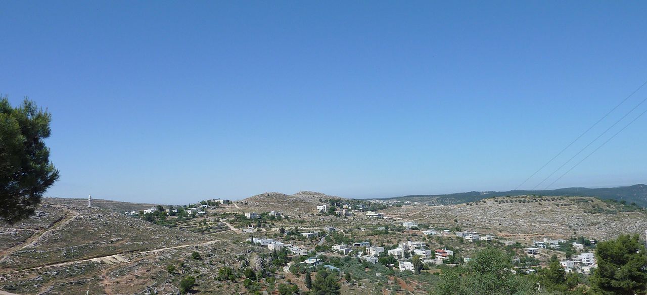
Al-Walaja stood on a mountain slope on the north side of Wadi al-Sarar, eight and a half kilometers west of Jerusalem, where a natural opening in the hills carried the road and the railway toward the coast. Its stone houses, divided by narrow winding alleys, looked over terraced slopes fed by five groups of springs, among them Ein Haniya; its people grew grain in the low ground and olives, grapes, and vegetables on the terraces, and quarried the building stone typical of the Jerusalem hills. The 1945 British survey counted 1,650 residents, all Muslims, on some 17,700 dunams — a village with a reputation, still repeated today, as the most beautiful in Palestine.
The end came in the autumn fighting of 1948. On the night of 21 October, during Operation Ha-Har, the Etzioni Brigade’s Eighth Battalion attacked the village, then held by Egyptian irregulars and local fighters; Arab counterattacks drove the Israelis back out within days. Al-Walaja’s fate was settled at the negotiating table instead: under the armistice agreement signed with Jordan on 3 April 1949, the village was handed over, and Israeli troops entered in the following weeks. Its people had fled east, but unlike most villages of the district, al-Walaja was not lost whole — roughly a third of its lands lay on the West Bank side of the new line, and there the displaced regrouped and rebuilt the village.
Old al-Walaja, west of the line, survives as rubble, terraces, and wild almond trees beside moshav Aminadav, established on village lands in 1950. The rebuilt village — partly annexed to Jerusalem’s municipality after 1967, partly in the Bethlehem governorate — has been closed in from every side: the settlements of Gilo and Har Gilo overlook it, the spring of Ein Haniya has been absorbed into an Israeli park, and the separation barrier, where complete, encircles it almost entirely. One of the few villages of 1948 whose people remain on their land, al-Walaja has become an enclave.
Sources
Cited works
3- palestineremembered.com — index(opens in a new tab)https://www.palestineremembered.com/Jerusalem/al-Walaja/index.html
- zochrot.org — en(opens in a new tab)https://www.zochrot.org/villages/village_details/49135/en
- palquest.org — al walaja(opens in a new tab)https://www.palquest.org/en/place/16901/al-walaja
Connected in the archive
27 connected records27 records elsewhere in the archive are linked to this one, each by a piece of evidence you can read below.
named in this record — 1 record
One record names the other. A pointer for reading, not a claim that they belong to each other.
- Jerusalemالقدس
Evidence — Inferred from the text — read the evidence: Al-Walaja stood on a mountain slope on the north side of Wadi al-Sarar, eight and a half kilometers west of Jerusalem, where a natural opening in the hills carried the road and the railway toward the coast.
in the same district — 26 records
Filed near each other — the same Mandate district, or the same uncommon subject tags.
- 'Allarعَلاّر
Evidence — From a recorded field in this archive: Both recorded in the Jerusalem district.
- 'Artufعَرْتُوف
Evidence — From a recorded field in this archive: Both recorded in the Jerusalem district.
- 'Islinعِسْلِين
Evidence — From a recorded field in this archive: Both recorded in the Jerusalem district.
- Al-Malihaالمالِحَة
Evidence — From a recorded field in this archive: Both recorded in the Jerusalem district.
- Al-Qabuالقبو
Evidence — From a recorded field in this archive: Both recorded in the Jerusalem district.
- Al-Qastalالقسطل
Evidence — From a recorded field in this archive: Both recorded in the Jerusalem district.
- and 20 more
Cite this page
Every claim above carries its sources — citation is the point.
- Chicago
“Al-Walaja.” Village Memory, FALASTEEN.AI. Accessed 22 August 2026. https://falasteen.ai/memory/al-walaja.- MLA
“Al-Walaja.” Village Memory, FALASTEEN.AI, 2026, https://falasteen.ai/memory/al-walaja. Accessed 22 August 2026.- BibTeX
@misc{falasteen-al-walaja,
  title        = {Al-Walaja},
  howpublished = {\url{https://falasteen.ai/memory/al-walaja}},
  organization = {FALASTEEN.AI — A Living Archive for Palestine},
  year         = {2026},
  note         = {Accessed 2026-08-22}
}