Ramla district · depopulated 1948 · 3 min read
Abu Shusha
أبو شوشة
Abu Shusha stood on the southern slope of Tall Jazar — ancient Gezer — eight and a half kilometres southeast of Ramla, with 870 people and 9,425 dunums in 1944/45. The Givati Brigade mortared and stormed it on 13–14 May 1948 during Operation Barak; research by Birzeit University puts the number killed at around sixty, and a mass grave holding fifty-two skeletons was uncovered on the site in 1995.
See Abu Shusha on the Atlas31.8569°N · 34.9156°E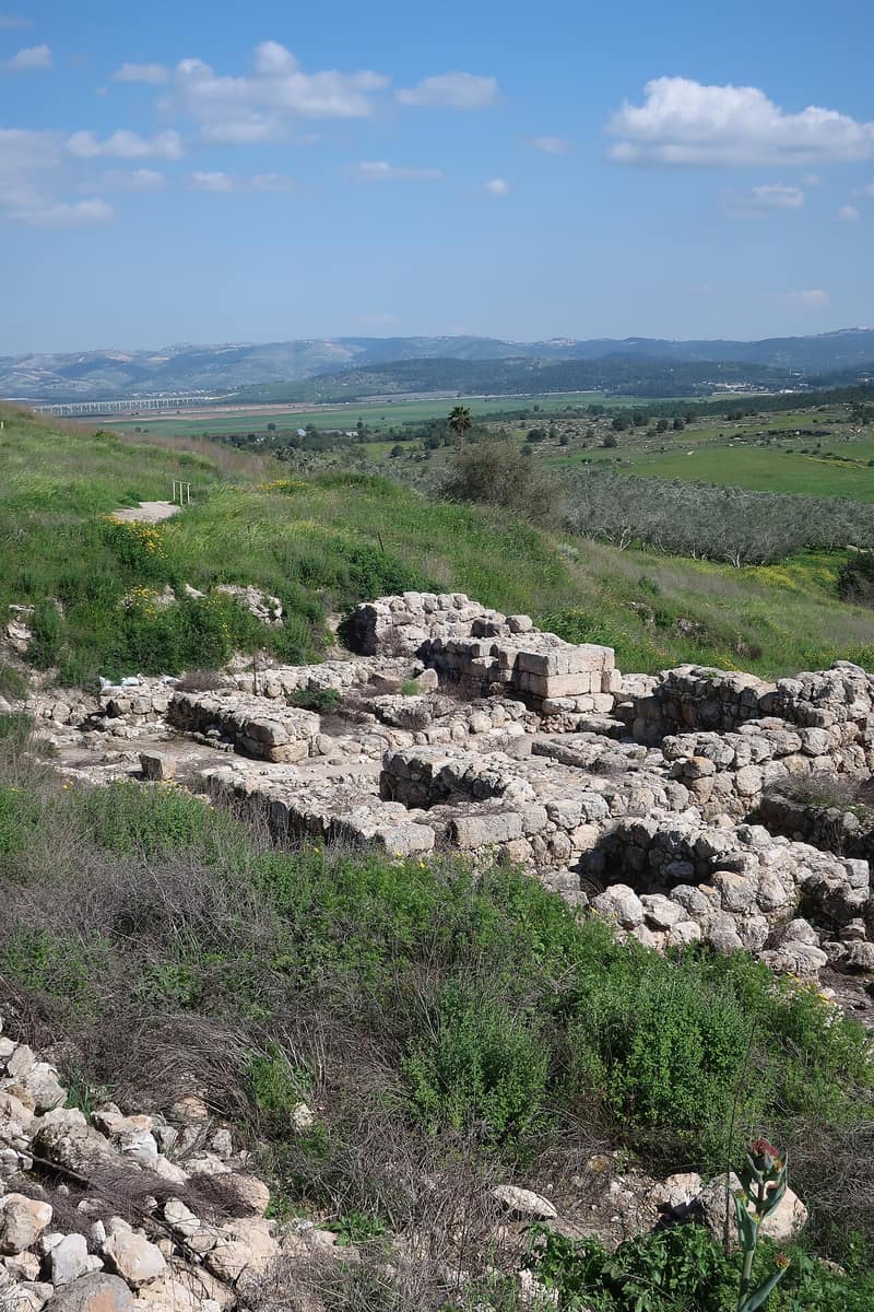
Abu Shusha stood on the southern slope of Tall Jazar, where the coastal plain meets the Jerusalem foothills, eight and a half kilometres southeast of Ramla and joined by a secondary road to the Jaffa–Jerusalem highway. The tell is identified with the Old Testament city of Gezer, one of the towns listed among Thutmose III’s conquests around 1469 BCE and later, by tradition, a stronghold of Solomon; it prospered under the Persians and the Greeks, was called Gazara by the Romans, and lay within the jurisdiction of Nicopolis — the site of the village of Imwas, itself destroyed in June 1967. The Crusaders knew the place as Mont Gisart, and in 1177 fought a battle there in which Salah al-Din’s troops were defeated. A maqam on the tell appears to date from the sixteenth century.
In the early nineteenth century Abu Shusha was a village of stone and mud ringed by cactus hedges, with about a hundred families. Its whole population was Muslim; the houses were built close together of mud and stone, and the village had a mosque, a number of shops, and an elementary school founded in 1947 with thirty-three pupils in its first intake. In 1944/45 it counted 870 people and 9,425 dunums, of which 2,475 were sown in cereals and 54 irrigated or planted in orchards; by then 6,337 dunums were in Jewish ownership.
The first attack came on the night of 1 April 1948, in what the History of the Haganah called the model of a studied retaliatory operation, mounted after a guard from the nearby settlement of Gezer was killed while trespassing on the village’s fields: two platoons of the Givati Brigade’s Second Battalion infiltrated the village after midnight and demolition men blew up a house and a well, while militia reinforcements from al-Qubab clashed with the covering force. The village fell on 13–14 May 1948 during Operation Barak, at the hands of the Givati Brigade’s 51st and 54th battalions. Benny Morris records that the attacking units shelled Abu Shusha with mortars the night before it fell, that the residents fled, and that some of the houses were dynamited. Estimates of the dead range from an Israeli claim of thirty to Arab claims of more than seventy; research by Birzeit University puts the figure at around sixty. An Arab Legion unit reported on 19 May that the Jews were killing villagers, and Arab authorities reported to the Red Cross that barbaric acts had been committed there. The remaining inhabitants were expelled on about 21 May. In 1995 a mass grave containing fifty-two skeletons was uncovered on the site; the cause of death was not established.
The settlement of Ameilim was established on the site of the destroyed village in 1948, and Pedaya on its lands in 1951; what was left of the village buildings was destroyed in 1965. Fig and cypress trees, cactus and a single palm grow over the site, and the valleys around it are planted with apricots and figs. Descendants of the villagers were counted at about 6,198 in 1998.
Sources
Cited works
3- palquest.org — abu shusha al ramla(opens in a new tab)https://www.palquest.org/en/place/20609/abu-shusha-al-ramla
- zochrot.org — en(opens in a new tab)https://www.zochrot.org/villages/village_details/49491/en
- en.wikipedia.org — Abu Shusha massacre(opens in a new tab)https://en.wikipedia.org/wiki/Abu_Shusha_massacre
Connected in the archive
25 connected records25 records elsewhere in the archive are linked to this one, each by a piece of evidence you can read below.
named in this record — 4 records
One record names the other. A pointer for reading, not a claim that they belong to each other.
- Al-Qubabالقُباب
Evidence — Inferred from the text — read the evidence: …the Givati Brigade's Second Battalion infiltrated the village after midnight and demolition men blew up a house and a well, while militia reinforcements from al-Qubab clashed with the covering force.…
- Dunum
Evidence — Inferred from the text — read the evidence: In 1944/45 it counted 870 people and 9,425 dunums, of which 2,475 were sown in cereals and 54 irrigated or planted in orchards; by then 6,337 dunums were in Jewish ownership.
- Imwasعمواس
Evidence — Inferred from the text — read the evidence: The tell is identified with the Old Testament city of Gezer, one of the towns listed among Thutmose III's conquests around 1469 BCE and later, by tradition, a stronghold of Solomon; it prospered under the Persians and the Greeks, was called Gazara by the Romans, and lay within the jurisdiction of Nicopolis — the site of the village of Imwas, itself destroyed in June 1967.
- Ramleالرملة
Evidence — Inferred from the text — read the evidence: Abu Shusha stood on the southern slope of Tall Jazar, where the coastal plain meets the Jerusalem foothills, eight and a half kilometres southeast of Ramla and joined by a secondary road to the Jaffa–Jerusalem highway.
in the same district — 21 records
Filed near each other — the same Mandate district, or the same uncommon subject tags.
- Al-Magharالمَغار
Evidence — From a recorded field in this archive: Both recorded in the Ramla district.
- Al-Muzayri'aالمُزَيْرِعَة
Evidence — From a recorded field in this archive: Both recorded in the Ramla district.
- Al-Na'aniالنَعاني
Evidence — From a recorded field in this archive: Both recorded in the Ramla district.
- Al-Nabi Rubinالنبي رُوبِين
Evidence — From a recorded field in this archive: Both recorded in the Ramla district.
- Al-Qubaybaالقُبَيْبَة
Evidence — From a recorded field in this archive: Both recorded in the Ramla district.
- Al-Sarafandسرافند الخراب
Evidence — From a recorded field in this archive: Both recorded in the Ramla district.
- and 15 more
Cite this page
Every claim above carries its sources — citation is the point.
- Chicago
“Abu Shusha.” Village Memory, FALASTEEN.AI. Accessed 22 August 2026. https://falasteen.ai/memory/abu-shusha-ramla.- MLA
“Abu Shusha.” Village Memory, FALASTEEN.AI, 2026, https://falasteen.ai/memory/abu-shusha-ramla. Accessed 22 August 2026.- BibTeX
@misc{falasteen-abu-shusha-ramla,
  title        = {Abu Shusha},
  howpublished = {\url{https://falasteen.ai/memory/abu-shusha-ramla}},
  organization = {FALASTEEN.AI — A Living Archive for Palestine},
  year         = {2026},
  note         = {Accessed 2026-08-22}
}