Jerusalem district · depopulated 1948 · 1 min read
Suba
صوبا
Suba stood on a conical hill above the Jerusalem–Tel Aviv road, its stone houses built among the ruins of a Crusader castle. Captured in July 1948 during Operation Danny, it survives as one of the more complete village ruins in the Jerusalem corridor, within a national park beside Kibbutz Tzova.
See Suba on the Atlas31.7847°N · 35.1239°E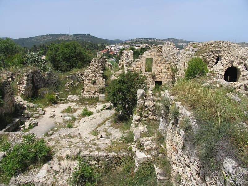
Suba occupied the summit of a conical hill rising 769 meters above the Jerusalem hills, about seven kilometers west of the city, commanding the road down to Tel Aviv. The village was built among the remains of Belmont, a Crusader castle taken by Saladin, and its people — 620 in the 1945 British survey, all Muslims — grew grain and tended orchards and springs on the slopes below.
Because of its position over the highway, Suba saw fighting from the first months of the war. Irregulars of the Egyptian Muslim Brotherhood stationed in the village joined attacks on Jewish traffic on the Tel Aviv–Jerusalem road, and the Haganah attacked it several times; an assault on 3 April, pressed even with air support, was beaten back. The end came in the summer: on the night of 12–13 July 1948, during Operation Danny, Palmach units conquered Suba. Most of its people had fled under the shelling, and those who remained were expelled.
In October 1948, Palmach veterans founded a kibbutz — later named Tzova — on village lands a kilometer to the south. Today the hilltop is Tel Tzova, a national park ringed by the kibbutz’s fields, where the stone shells of village houses stand mixed with the walls of Belmont Castle above the highway. Two books by writers from the village, published in Amman and in the West Bank, have carried Suba’s memory into exile.
Sources
Cited works
3- palestineremembered.com — index(opens in a new tab)https://www.palestineremembered.com/Jerusalem/Suba/index.html
- zochrot.org — en(opens in a new tab)https://www.zochrot.org/villages/village_details/49356/en
- palquest.org — suba(opens in a new tab)https://www.palquest.org/en/place/17150/suba
Connected in the archive
26 connected records26 records elsewhere in the archive are linked to this one, each by a piece of evidence you can read below.
in the same district — 26 records
Filed near each other — the same Mandate district, or the same uncommon subject tags.
- 'Allarعَلاّر
Evidence — From a recorded field in this archive: Both recorded in the Jerusalem district.
- 'Artufعَرْتُوف
Evidence — From a recorded field in this archive: Both recorded in the Jerusalem district.
- 'Islinعِسْلِين
Evidence — From a recorded field in this archive: Both recorded in the Jerusalem district.
- Al-Malihaالمالِحَة
Evidence — From a recorded field in this archive: Both recorded in the Jerusalem district.
- Al-Qabuالقبو
Evidence — From a recorded field in this archive: Both recorded in the Jerusalem district.
- Al-Qastalالقسطل
Evidence — From a recorded field in this archive: Both recorded in the Jerusalem district.
- and 20 more
Cite this page
Every claim above carries its sources — citation is the point.
- Chicago
“Suba.” Village Memory, FALASTEEN.AI. Accessed 22 August 2026. https://falasteen.ai/memory/suba.- MLA
“Suba.” Village Memory, FALASTEEN.AI, 2026, https://falasteen.ai/memory/suba. Accessed 22 August 2026.- BibTeX
@misc{falasteen-suba,
  title        = {Suba},
  howpublished = {\url{https://falasteen.ai/memory/suba}},
  organization = {FALASTEEN.AI — A Living Archive for Palestine},
  year         = {2026},
  note         = {Accessed 2026-08-22}
}